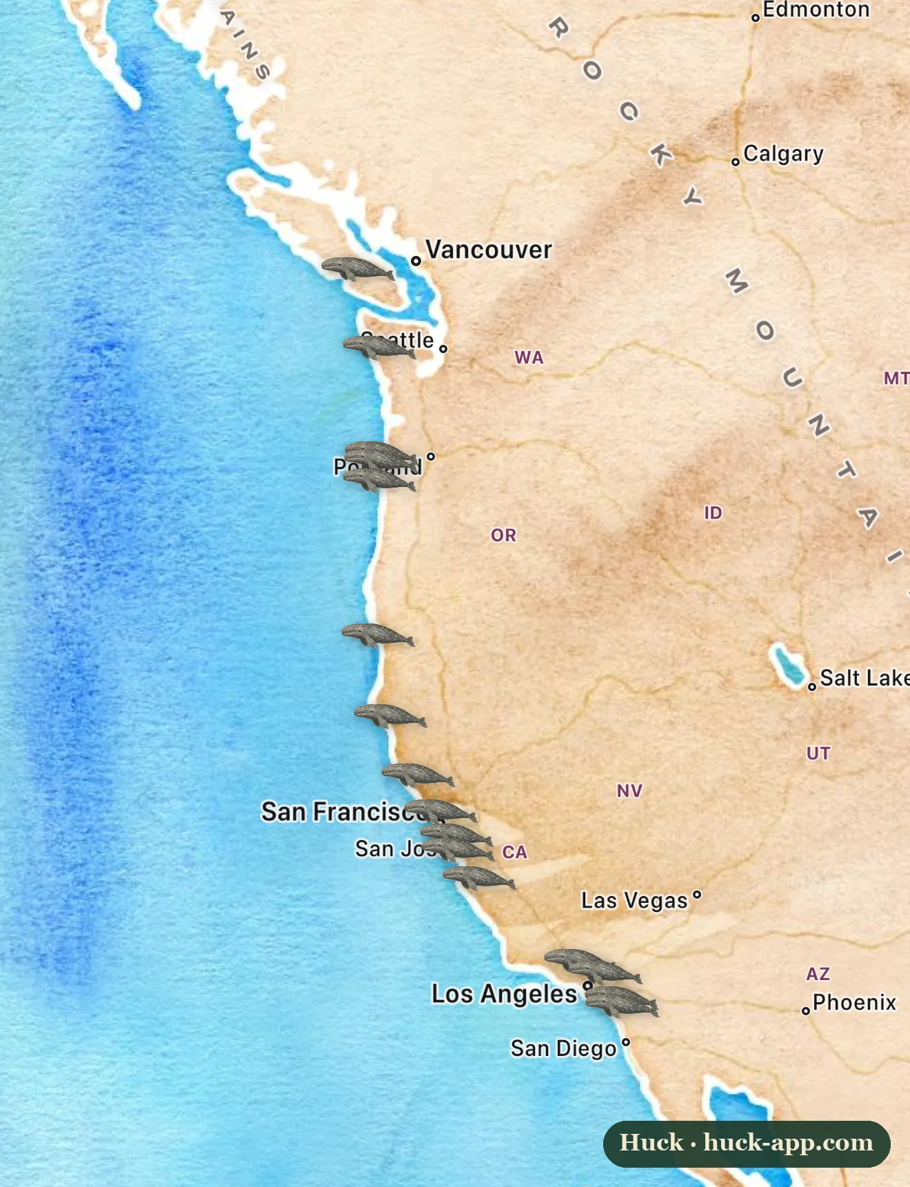
Most whales live too far offshore to see without a boat. The gray whale is the great exception. Twice a year it travels the length of the Pacific coast of North America in one of the longest migrations of any mammal, and it hugs the shoreline closely enough that you can stand on a cliff or a jetty, scan the water, and watch a two-story spout drift by. Right now the southbound parade is underway, and the map shows the headlands where people gather to catch it.
A ten-thousand-mile round trip
Gray whales spend the summer gorging in the cold, rich waters of the Arctic, off Alaska and beyond, then swim all the way down to a cluster of warm, shallow lagoons in Baja California, Mexico, to give birth. The round trip runs somewhere around ten to twelve thousand miles, and the whales do much of it within sight of land. They are bottom-feeders, rolling onto their sides to suck up mouthfuls of seafloor mud and strain out tiny shrimp-like creatures, which is part of why they travel the coastal shallows the way they do. In the Baja lagoons some of them famously approach small boats to be touched, the only whales on Earth with a regular habit of it.
Where to watch
Almost any coastal overlook on the route can produce whales, but a few are institutions. Depoe Bay on the Oregon coast calls itself the whale watching capital and keeps a staffed watch center on the seawall. Point Reyes and the Monterey Peninsula are the great northern and central California vantage points. In the south, Point Vicente on the Palos Verdes bluffs, Dana Point, and the Cabrillo National Monument above San Diego draw steady crowds, and Dana Point leans so hard into it that it brands itself the whale watching capital of the world. Farther north, Cape Flattery in Washington anchors the top of the route.
When to go
There are two passes, and they look different. The southbound migration toward Baja peaks from late December into January, the whales moving fast and with purpose. The northbound return runs from about February into May, and that is the one to catch for mothers and calves, which travel slowly and tuck in extra close to shore to shelter the young from orcas. Oregon and California run organized whale-watch weeks around the winter holidays. Pick a calm, bright day, find a high point, and watch for the blow: a puff of mist hanging over the water is how you spot a whale long before you see the whale.
Back from the brink, with a wobble
Commercial whaling drove the gray whale to the edge twice over, and the western Pacific population is still in serious trouble. But the eastern population, the one that streams past California, is one of the clear success stories of whale protection: hunted down to a remnant, then recovered over the twentieth century to around twenty thousand animals. It has not been a straight line. A recent stretch of elevated deaths along the coast, tied to conditions on the Arctic feeding grounds, thinned the numbers again before they began to steady. The whales going by this winter are a population that has come back before, working through another hard patch.
About the map and the data
Gray whales are hard to map from community photos, because a whale seen from shore is a spout and a glimpse of back, not an easy, verifiable record, and there are relatively few such entries. So rather than plot sparse sightings, the markers here are placed at established shore-based viewing sites along the migration route, the headlands, points, and watch centers where the whales pass close and people reliably see them. The migration timing and population history draw on NOAA Fisheries and marine mammal research.