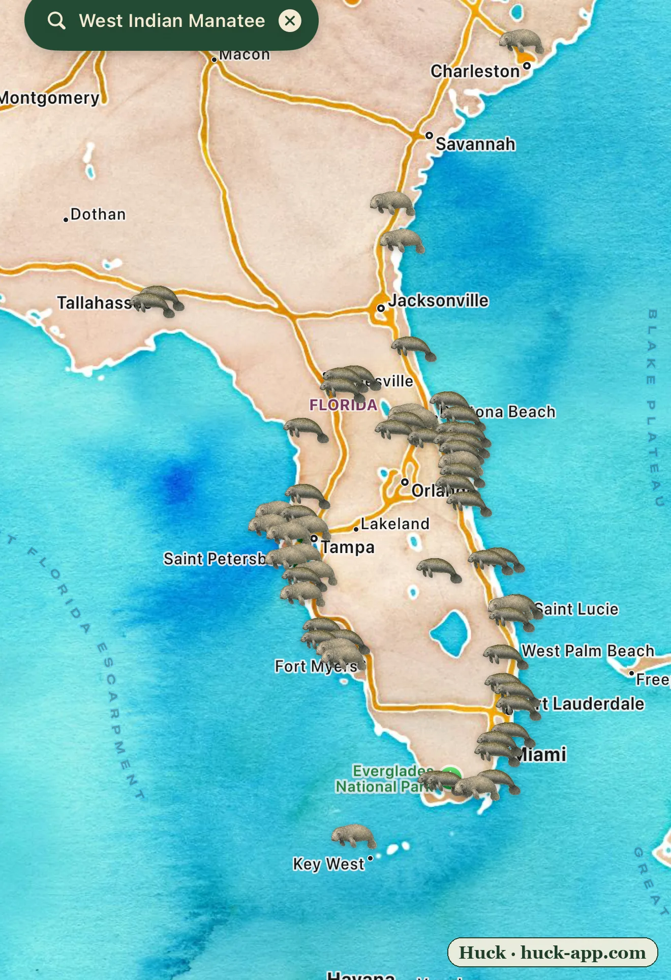
A thousand-pound vegetarian with no natural predators should be one of the easiest animals in Florida to keep alive. The manatee is one of the hardest. The map above shows where they gather, and if you look closely it is really two maps in one: a temperature map in winter, and a food map all year, and both of those maps are shrinking.
The cold problem
For all their bulk, manatees carry very little insulating fat, and they cannot survive for long in water below about 68 degrees. A hard cold snap kills them outright, from a condition called cold stress. So as the water cools each fall and winter, manatees crowd into a handful of warm refuges: natural springs that pour out of the Florida aquifer at a constant 72 degrees, like Crystal River and Blue Spring, and, increasingly, the warm-water discharge canals of coastal power plants. Hundreds of animals can pack into a single spring. Those dense clusters on the map are the havens that get them through winter.
A refuge we accidentally built, and might remove
That crowding hides a trap. A large share of Florida’s manatees now depend on the warm outflow of power plants that did not exist a century ago, water the animals treat exactly like a natural spring. As those aging plants retire or go offline, the artificial warm water can disappear overnight, sometimes with no natural spring anywhere nearby for the manatees that learned to winter there. We quietly became their landlords, and it is not clear we have a plan for when the lease ends.
The starvation years
Then there is the food, and this is where the story turned grim. Along the Atlantic coast, the Indian River Lagoon, that long dense band of pins from Daytona down past Vero Beach, was one of the richest manatee habitats in the state until decades of nutrient pollution fed algae blooms that blotted out the sunlight and killed the seagrass manatees eat. The result was an Unusual Mortality Event: in 2021, a record of roughly 1,100 manatees died in Florida, many of them simply starving in water that no longer grew their food. Wildlife agencies took the almost unheard-of step of hand-feeding wild manatees tons of lettuce through the winter to keep them alive, and lawsuits over the lagoon’s water quality are still working through the courts.
Downlisted, and contested
In 2017, manatees were downlisted from endangered to threatened, a decision conservation groups fought at the time and have pushed to reverse since the die-off. Add the constant background threat of boat strikes, so common that researchers identify individual manatees by the unique propeller-scar patterns on their backs, and you have an animal squeezed from three directions at once: too little warm water, too little food, too many boats.
What the community data shows
This map is built from roughly 10,000 research-grade manatee observations in Florida on iNaturalist. The coordinates are obscured to protect the animals, so the pins are approximate, and sightings lean toward where people are, since manatees are beloved and heavily photographed at spring-run viewing platforms and marinas. But the pattern is real and it is the whole point: manatees are concentrated onto a small number of warm, food-rich places, and both the warmth and the food are less secure than they look.
About the data
Sightings shown are research-grade community observations from iNaturalist, mapped in Huck; counts are current as of August 2026. Manatee coordinates are obscured by iNaturalist to protect the species, so those pins are approximate. Mortality figures, the Indian River Lagoon seagrass collapse, the emergency feeding program, and the 2017 downlisting draw on Florida Fish and Wildlife Conservation Commission and US Fish and Wildlife Service records.